Maximizing Development Application Approvals: The Role of 3D Renderings in Streamlining Processes
by RealSpace
The property development landscape is evolving rapidly with technological advancements. One such advancement, 3D rendering, is transforming how architects, developers, and planners approach development and rezoning applications. These digital models offer a vivid, interactive visualization of projects, enabling all stakeholders to understand a proposed development's nuances thoroughly. This article explores the ways 3D renderings can streamline the approval process and increase the chances of success for development and rezoning applications.
The Traditional Challenges in Development and Rezoning Applications
Historically, developers relied on 2D drawings, text descriptions, and perhaps some rudimentary models to present their plans to planning commissions, local authorities, and the community. These conventional methods often left room for interpretation and could lead to misunderstandings, delays, or even project rejections.
The Rise of 3D Renderings
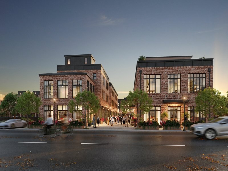
In contrast, 3D renderings offer a high level of detail and an interactive experience. They can be exceptionally realistic, providing a virtual walkthrough that allows people to 'experience' the space before it's built. Here's how they can be beneficial:
Improved Communication and Clarity
3D renderings leave less to the imagination, reducing misunderstandings or misinterpretations. When stakeholders can visualize precisely how a project will impact their community or property, it becomes easier to discuss concerns, modifications, or improvements.
Enhanced Public Engagement
Traditional public hearings often involve complicated plans that can be difficult for the public to understand. 3D renderings make conveying the developer's vision easier, helping the community grasp the project's scale, design, and impact better. This increased level of transparency can lead to higher levels of public support.
Facilitating Decision-making for Authorities
For planning authorities, 3D renderings can be an invaluable tool for making informed decisions. They can assess how a development fits into existing urban landscapes, view shadow studies, or even understand traffic flow, all of which are crucial for successful planning.
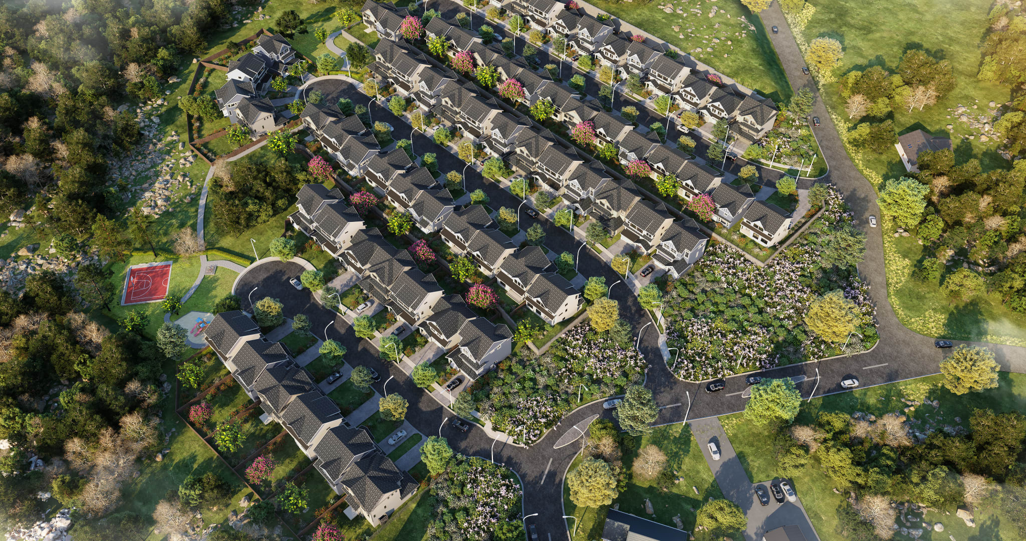
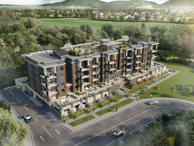
Incorporating Drone Imagery with 3D Renderings for Enhanced Realism
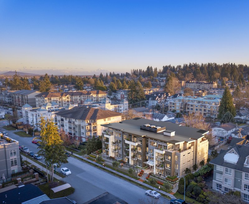
One of the most groundbreaking advancements in 3D rendering technology is its integration with drone imagery . This combination offers unparalleled detail and realism, providing a bird's-eye view of how a proposed project will integrate into its existing environment. The synthesis of these two technologies has several benefits that can significantly improve the success rate of development and rezoning applications.
Seamless Integration with Real-world Context
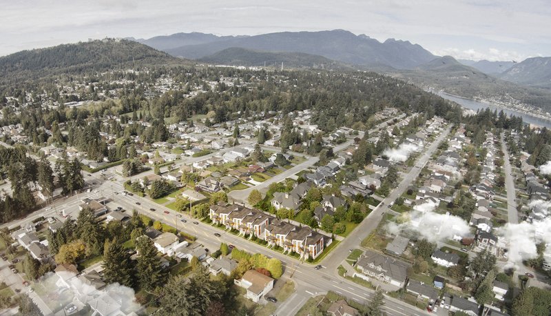
By imposing 3D-rendered models onto high-resolution drone images, developers can create composite images that situate the proposed project within its real-world context. This offers unprecedented realism, allowing planning committees, stakeholders, and community members to understand how the fresh development will interact with existing structures, natural landscapes, and community landmarks.
Enhanced Stakeholder Engagement
Drone images capture attention. When people see a familiar setting — perhaps even their neighbourhood — from an aerial perspective, it sparks interest. Add to that a 3D rendering of a proposed development, and you have an incredibly powerful tool for engaging the public. By seeing how the development fits into a broader context, community members can better appreciate its scale, design, and potential impact, leading to more informed discussions and, potentially, quicker approval processes.
Precise Impact Assessments
Drone imagery allows for accurate scale and spatial relations. When 3D renderings are incorporated into these images, it becomes possible to conduct precise impact assessments. For example, planners can evaluate how a new building will affect line-of-sight views from different angles, assess the environmental impact, or determine how shadows will fall at different times of the day and year. These assessments can provide crucial data for planning committees, speeding up decision-making.
Cost and Time Efficiency
Though the upfront costs of creating high-quality 3D renderings and capturing drone footage might seem steep, the potential time and cost savings are substantial in the long run. A compelling, realistic visual representation can dramatically shorten approval timelines, reduce the likelihood of costly revisions, and increase the odds of first-time application success.
Speeding Up the Approval Process
Time is often of the essence in property development. Delays in gaining approvals can lead to increased costs and may even jeopardize a project's viability. 3D renderings can significantly speed up the approval process by quickly resolving any ambiguities or concerns, making it easier for all parties to reach a consensus.
Increasing Chances of Approval
3D renderings allow developers to present their projects in the best possible light by offering a more comprehensive view of a project. This fuller understanding can sway opinions and pave the way for project approval, especially in contentious or borderline cases.
Conclusion
3D renderings have revolutionized the property development sector, notably improving communication between developers, authorities, and communities. As a tool, they streamline gaining approvals and increase the likelihood of success for development and rezoning applications. In an industry with high stakes, employing 3D renderings can be the difference between the green light for construction and a back-to-the-drawing board.