What is 3D Rendering? | Everything there is to know about 3D Rendering
What is 3D Rendering?
Definition:
3D Rendering refers to creating a 2D image or animation (a collection of multiple images played back at a specific frame rate) of a 3D model generated by specialized computer software.
It involves building a virtual scene with 3D objects, setting up lighting and materials to make them look realistic, and then generating the final images or animations based on the way a rendering program interprets the information.
It allows us to visualize and bring imaginary worlds, objects, and characters to life on our screens, making them look as close to real as possible (or as unreal as the artist may wish).
History of 3D Rendering:
The history of 3D rendering dates back to the late 1960s and early 1970s when computer graphics researchers began exploring techniques for creating realistic and immersive visual representations. Initially, rendering was a time-consuming process limited to specialized hardware and software. However, advancements in computing power and algorithms led to significant progress in the field. The 1980s witnessed the emergence of pioneering rendering software like Pixar's RenderMan and advancements in ray tracing techniques. The 1990s saw further improvements with the introduction of commercial software such as 3ds Max and Maya, enabling wider accessibility to 3D rendering tools. As computer graphics technology continued to evolve, rendering techniques expanded to include global illumination, physically-based rendering, and real-time rendering. Today, 3D rendering has become an integral part of various industries, including architecture, film, gaming, and virtual reality, enabling the creation of stunning and immersive visual experiences.
3D Rendering in simple terms

Let's embark on a journey to demystify the world of 3D rendering by using a simple metaphor we can all imagine.
Envision a ball of clay as our starting point to grasp the concept.

Just like a sculptor moulds clay into various shapes, in the realm of 3D modeling, artists manipulate virtual objects, stretching, squishing, and rotating them to their heart's desire.
Now, suppose you sculpt the clay into a human bust. To enhance realism, you paint the skin, add detailed features like red lips, brown eyes and black hair, and even crown it with a striking blue hat. This process mirrors the art of texturing a 3D model, where artists add lifelike details to the surface of an object to make it visually appealing.
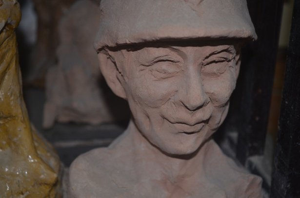
The journey doesn't end there. After painting your clay sculpture, you realize the lighting needs a touch of dynamism to capture all the intricacies you've added. Just like an adept photographer, you open the blinds to let in ambient light, position additional lamps to create depth, and strategically place a small flashlight to create a subtle rim light. These lighting adjustments closely resemble the art of lighting in 3D rendering, where virtual lights are set up within the scene.

Now that your masterpiece is ready, it's time to capture it through a camera lens. With your tripod-mounted camera, you frame the subject and click the shutter button. The camera expertly captures the interplay of light, reflecting the colors and shapes of your sculpture—a parallel to the 3D rendering process, where powerful software calculates light interactions within a 3D scene to generate stunning images.
What to expect when working with a 3D rendering company
Working with a professional 3D rendering company can be a game-changer for architectural projects, as it bridges the gap between imagination and reality. Whether you are an architect looking to present your design to clients or a homeowner planning a renovation, collaborating with a rendering company can bring your vision to life and provide valuable insights into the final outcome.
Hiring a 3D rendering company for your architectural visualization needs can be a daunting task. The world of 3D rendering is intricate and multifaceted, and understanding the minutae of the process can seem overwhelming at first. We empathize with the confusion and uncertainty that can arise when seeking the right partner to bring your design visions to life.
A successful collaboration with a 3D rendering company starts with a clear understanding of the process. While the specific steps may vary depending on the company and project, there are common stages involved in creating architectural renderings.
Typical 3d rendering project workflow:
Initial Consultation and Project Scope:
- The process usually begins with an initial consultation where you discuss your project requirements, objectives, and timelines with the rendering company. This is an opportunity to communicate your vision and any specific details you want to be included in the rendering.
Gathering Necessary Information and Assets:
- To proceed with the rendering, the company will need relevant information such as architectural plans, sketches, CAD files, material references, and photographs. Providing these assets in a clear and organized manner helps ensure accuracy and efficiency in the rendering process.
Conceptualization and Design Development:
- Based on the provided information, the rendering company will start conceptualizing the design and developing a 3D model. This involves creating a digital representation of the architectural project, often referred to as a clay rendering. The clay rendering is primarily used to establish the basic model and map out the ideal camera positions and compositions.
Initial drafts with full detail renderings
- Once the camera angles have been confirmed, the rendering company is able to proceed with adding details to the model such as textures, lighting, human entourage in post production etc.
Iterative Feedback and Revisions:
- Once the initial rendering is ready, you will have the opportunity to review and provide feedback. Collaboration and open communication during this stage are crucial for achieving the desired outcome. You can request revisions and adjustments to align the rendering with your vision. The more specific you are about your needs, the easier it will be for the rendering company to accurately incorporate these changes. At RealSpace 3D we allow 3 rounds of revisions during the rendering process.
Final Rendering and Delivery:
- Once feedback has been incorporated and necessary revisions have been made, the rendering company will proceed to finalize the rendering in the desired image or video format. In order to protect their work, some companies may choose to include watermarks in the renderings until the final payment has been made. This ensures that the company's intellectual property rights are safeguarded during the project's completion.
What files you need to provide in order to get a 3D rendering started
When working on an architectural rendering project, it is important to understand the types of files and assets that are needed to bring your vision to life. Proper file preparation and organization ensure a seamless collaboration with the rendering company. Here are the key files required for an architectural rendering project, including architectural files and FF&E (Furniture, Fixtures, and Equipment) assets:
Architectural Files:
File types:
CAD drawings are great for 3d rendering as they provide detailed building information that can be directly importing into 3d rendering software.
PDFs are commonly used for easy sharing and quick reviews
SketchUp files offer 3D models which are less detailed than the ones typically used in high quality architectural renderings, but they are a great starting point.
Architectural drawing types:
Here are some of the different drawings you may need to provide the architectural rendering company,
- Elevation Drawing: A depiction of the building's exterior view, showcasing the vertical surfaces and architectural features.
- Floor Plan: A top-down view of the building's layout, illustrating the arrangement of rooms and architectural elements on a specific floor level.
- Site Plan: An overview of the property, including boundaries, topography, and site-specific features, providing context for the building's placement.
- Section Plan: A vertical slice of the building, revealing internal structure and construction details, aiding in understanding spatial relationships.
- Roof Plan: A detailed representation of the roof's layout, design, and architectural features.
These drawings are crucial for 3D rendering as they provide essential information about the building's appearance, layout, context, and internal structure, enabling accurate and realistic renderings.
Most effective way to convey the types of exterior materials to use:
When conveying the types of exterior materials for a 3D rendering, it is best to provide clear and specific information. Utilize material samples, product links, reference images, or detailed descriptions to communicate the desired textures, colors, and finishes. If you are not sure what would look good try looking at some examples of 3d textures to get an idea of what you need.
How to best select architectural entourage for your project:
When conveying information about demographics for use in architectural rendering entourage, it is important to gather comprehensive data about the target audience or the intended occupants of the space. This includes factors such as age range, cultural background, profession, lifestyle, and specific needs or preferences. Visual references like photographs or mood boards can help illustrate the desired demographic characteristics. Additionally, providing contextual information about the purpose and function of the space can assist in accurately selecting the appropriate entourage elements. By effectively conveying demographic information, rendering professionals can create realistic and relatable representations that align with the intended users of the architectural design.
Types of interior design details a 3D rendering may require:
- Furniture Models: If you want specific furniture pieces included in the renderings, you will need to provide 3D models or references for those items. This ensures accurate representation of the furniture within the architectural context. Furniture models can be obtained from manufacturers or created through custom modeling. Be sure to indicate if you require exact match furniture usage in your interior renderings or if items from the 3d renderer’s library would be sufficient.
- Lighting Fixtures: Lighting fixtures greatly impact the ambiance and mood of architectural renderings. If you have specific lighting fixtures in mind, share the 3D models or detailed references with the rendering company. This allows them to accurately place and illuminate the fixtures in the renderings, creating realistic lighting effects.
- Decorative Elements: Supplementary decorative elements, such as artwork, plants, or accessories, can enhance the visual appeal of the renderings. Provide references or 3D models of these elements to integrate them seamlessly into the scenes. These assets contribute to the overall aesthetic and help bring the spaces to life.
- Material and Finish Samples: If you have specific materials or finishes in mind for surfaces like flooring, walls, or countertops, providing physical or digital samples to the rendering company helps ensure accurate representation. This allows them to match the desired look and feel in the renderings.
By providing the necessary architectural files, including CAD drawings and 3D models, along with FF&E details such as furniture typesand material samples, you enable the rendering company to accurately recreate your design vision. Proper organization of files and adherence to preferred formats ensure a smooth collaboration and help achieve the desired outcome in the architectural renderings.
Understanding the Estimated Timeline for Rendering Projects
When embarking on an architectural rendering project, it is crucial to have a clear understanding of the estimated timeline. Rendering companies carefully assess the scope and complexity of each project to provide an accurate timeline. Factors such as project size, level of detail, and the number of deliverables influence the estimated duration.
Estimating project timelines involves considering the time required for each stage of the rendering process, including asset preparation, modeling, texturing, lighting, rendering, and post-production. Complex projects with intricate architectural designs or extensive interior detailing may naturally require more time than simpler ones.
Factors That May Affect the Project Duration
Several variables can impact the duration of a rendering project. It is essential to consider these factors to ensure a realistic timeline and avoid potential delays. Some of the factors that may influence project duration include:
- Revisions and Design Adjustments: Iterative feedback and revision cycles are common in rendering projects. While these iterations contribute to refining the final result, they can also extend the project timeline. Clear communication and prompt feedback help streamline this process.
- Additional Design Requests: Clients may request additional elements or design changes throughout the project, which can impact the timeline. It is important to have a mechanism in place to evaluate and assess the feasibility and implications of these requests.
- Technical Challenges: Technical difficulties or unforeseen issues can arise during the rendering process, such as software glitches or compatibility problems. Resolving these challenges may require additional time and expertise, impacting the project timeline.
Effective communication with the rendering company
Effective communication is crucial when working with a rendering company to ensure a smooth and successful collaboration. Here are some key points to consider:
- Establish clear channels: Set up regular communication channels with the rendering company, such as email, phone calls, or project management software. This enables efficient and consistent communication throughout the project.
- Designate a point of contact: Appoint a dedicated point person from your team who will be responsible for communicating with the rendering company. Having a single point of contact streamlines communication and reduces confusion.
- Active listening and clarity: Actively listen to the input and suggestions provided by the rendering company. Clearly communicate your expectations, goals, and any specific requirements you have for the project. This ensures a shared understanding and minimizes misunderstandings.
- Be Specific: Provide specific details and complete drawings when possible to minimize confusion and unnecessary revisions.
Providing clear project requirements and objectives
To achieve the desired outcome, it is essential to provide clear project requirements and objectives to the rendering company. Consider the following:
- Detailed brief: Prepare a comprehensive brief that outlines your project's scope, target audience, desired style, and any specific design elements or features you want to highlight. The more detailed and precise the brief, the better the rendering company can understand and meet your expectations.
- Visual references: Gather visual references, such as sketches, photographs, or mood boards, to help convey your vision and aesthetic preferences. These references provide a visual foundation for the rendering company to grasp your design intent accurately.
- Define project milestones: Clearly define the project milestones and deliverables, including intermediate review stages, to track progress and ensure alignment between both parties. This helps keep the project on schedule and allows for timely adjustments if needed.
3D Rendering Prices:
As you might expect, the cost of 3D rendering services varies significantly based on factors such as project complexity, scope, and quality expectations. For a detailed analysis of rendering pricing and the factors influencing it, we invite you to explore our dedicated pricing page .
Careers in 3D rendering
Embarking on a career as a 3D artist opens up a world of limitless creativity and boundless possibilities. As a 3D artist, you will delve into the realm of computer-generated imagery, crafting immersive visual experiences that blur the line between reality and imagination. From architectural visualizations that bring unbuilt structures to life, to fantastical characters and environments in gaming and animation, your skills as a 3D artist will shape captivating digital worlds. With a blend of technical expertise, artistic talent, and a passion for storytelling, you will have the opportunity to collaborate with diverse industries and contribute to projects that inspire, entertain, and leave a lasting impact on audiences.
While a career as a 3D artist offers exciting opportunities, it also comes with its fair share of challenges. Some of the key hurdles that potential 3D artists may encounter include:
- Technical Complexity: Mastering the intricate software tools and techniques required for 3D modeling, texturing, lighting, and rendering can be a steep learning curve. Keeping up with rapidly evolving technology and staying current with industry trends is an ongoing challenge.
- Continuous Learning: The field of 3D art is constantly evolving, with new software versions, rendering engines, and techniques emerging regularly. Artists need to commit to lifelong learning and staying updated with the latest advancements to remain competitive.
- Creative Problem-Solving: 3D artists often encounter complex creative challenges, from achieving realistic lighting and materials to solving technical issues during the rendering process. Finding innovative solutions and overcoming artistic and technical obstacles requires patience, perseverance, and a problem-solving mindset.
- Time and Deadline Management: Projects in the 3D industry can have tight deadlines, requiring artists to manage their time effectively and deliver high-quality work within specified timelines. Juggling multiple projects simultaneously can also pose a challenge, necessitating strong organizational and time management skills.
- Building a Portfolio and Networking: Establishing a strong portfolio is crucial for showcasing one's skills and attracting potential clients or employers. Building a portfolio requires time and effort, as well as networking with industry professionals to gain exposure and opportunities.
- Competition and Industry Demands: The field of 3D art is highly competitive, and standing out among a sea of talented artists can be challenging. Additionally, client demands and project requirements may vary greatly, requiring artists to adapt their skills to meet diverse needs and expectations.
Despite these challenges, a career as a 3D artist can be immensely rewarding for those passionate about the craft. With dedication, perseverance, and a commitment to continuous growth, aspiring artists can overcome these hurdles and thrive in the dynamic world of 3D art.
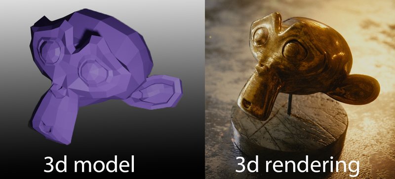
How a 3D rendering is made
At it's most fundamental level, these are the basic steps for creating 3d renderings
- 3D Modeling: A skilled artist models the virtual scene, shaping objects, structures, and characters.
- Materials and Texturing: Artists apply textures to the 3D models, making them appear realistic by simulating different surfaces like glass, concrete, or brick. Material setup determines characteristics such as glossiness and roughness.
- Lighting: Just as a photographer sets up lighting equipment, 3D artists configure lights within the virtual scene to mimic real-world lighting conditions, including sunlight and ambient illumination.
- Rendering: This is the moment of truth. The 3D software computes all the inputs—models, materials, and lighting—to generate the final 2D image or animation. The rendering time varies depending on scene complexity and desired quality.
- Post-production: This is where a lot of the magic happens. Post-production in programs like Photoshop, to add in subtle details, color corrections and little touches of magic to create a more appealing image.
- Refining: Iterative feedback loops with the client ensure the scene, textures, and lights meet the desired outcome. Revisions are made until the artist achieves the desired results.
- Final Delivery: The agreed-upon high-resolution 2D images or animations are provided to the client in a suitable format for their specific needs.
3D Modeling Software examples
When it comes to 3D modeling software, there are several options to choose from. Here, I present to you a selection of the most renowned and widely-used ones. Take a look at these popular choices in the realm of 3D modeling software.
- 3ds Max: 3ds Max is a professional 3D modeling, animation, and rendering software developed by Autodesk. It is widely used in industries such as film, gaming, and architecture. It offers a comprehensive set of tools for modeling, texturing, rigging, animation, and rendering. 3ds Max supports various modeling techniques, including polygonal modeling, NURBS, and subdivision surfaces. It also has a powerful plugin ecosystem that allows for extended functionality and integration with other software.
- Maya: Maya is another popular 3D modeling and animation software developed by Autodesk. It is widely used in the film, television, and gaming industries. Maya offers a wide range of features for modeling, animation, rigging, and rendering. It supports various modeling techniques, including polygonal modeling, NURBS, and subdivision surfaces. Maya also has a robust character animation toolkit and supports advanced simulation and visual effects capabilities.
- ZBrush: ZBrush is a digital sculpting and painting software developed by Pixologic. It is primarily used for creating highly detailed and organic 3D models. ZBrush uses a unique sculpting workflow that allows artists to manipulate models using customizable brushes and digital clay. It is widely used in the film, gaming, and toy industries for creating characters, creatures, and props. ZBrush also offers features for texturing, polypainting, and rendering.
- Cinema 4D: Cinema 4D is a professional 3D modeling, animation, and rendering software developed by MAXON. It is widely used in motion graphics, visual effects, and product visualization. Cinema 4D offers a user-friendly interface and a wide range of modeling tools, including polygonal modeling, NURBS, and subdivision surfaces. It has a powerful animation system, character rigging capabilities, and advanced rendering options. Cinema 4D also supports integration with other software and has a large plugin ecosystem.
- SketchUp: SketchUp is a 3D modeling software developed by Trimble Inc. It is known for its intuitive and easy-to-use interface, making it popular among beginners and architectural professionals. SketchUp offers a range of tools for creating 3D models, including simple shapes, architectural elements, and detailed objects. It also supports plugins that extend its functionality. SketchUp is often used for architectural design, interior design, and urban planning.
One of the most popular open-source 3D modeling software is Blender, which supports the entire 3D pipeline, including rendering, animation, modeling, compositing, and more. Wings 3D is another open-source software that specializes in visual mirroring for symmetric modeling. 3D Crafter, although not fully open-source, is recommended for aspiring 3D animators and offers drag-and-drop functionality for modeling.
3D Reshaper is a software dedicated to easy 3D modeling with a focus on topography, while Houdini Apprentice provides access to most of the tools available in the paid version of Houdini but with limitations on rendering file size and usage. FreeCAD is an open-source software that excels in designing real-life objects, while Daz Studio caters to artists and allows the creation of lifelike characters.
Other notable free 3D modeling software include DesignSpark, SketchUp, Mesh Magic, Open Cascade, Sculptris, NaroCAD, Vue 11 Personal Learning Edition, PTC Creo, OpenSCAD, Mesh Mixer, LEGO Digital Designer, TinkerCAD, and Art of Illusion. Each software offers unique features and capabilities tailored to specific applications and industries.
3D Rendering Software examples
In addition to 3D modeling software, rendering engines play a crucial role in finalizing the output of 3D designs. While commercial rendering engines can be expensive, there are free alternatives available. Cycles, developed by the team behind Blender, is a popular rendering engine known for its unbiased rendering and efficiency. Kerkythea specializes in rendering materials and light effects, providing realistic results. Freestyle is a customizable rendering engine that focuses on non-photorealistic line drawings.
There are various types of 3D rendering engines available, each offering different features and capabilities. Here are some of the main types:
- Scanline Rendering Engine: This type of rendering engine uses a scanline algorithm to render images. It works by scanning each horizontal line of the image and determining the color and intensity of each pixel.
Autodesk 3ds Max, Autodesk Maya Software Renderer, Cinema 4D Standard Renderer.
- Ray-Tracing Rendering Engine: Ray tracing is a technique that simulates the behavior of light in a 3D environment. Ray-tracing engines trace the path of light rays as they interact with objects in the scene, allowing for realistic rendering of reflections, refractions, and shadows.
NVIDIA Mental Ray, Chaos Group V-Ray, Pixar RenderMan.
- Radiosity Rendering Engine: Radiosity rendering focuses on the calculation of indirect lighting in a scene. It simulates the way light bounces off surfaces and interacts with other objects, resulting in soft and realistic lighting effects.
LightWave 3D Radiosity Renderer, Maxwell Render, Artlantis Studio.
- Global Illumination Rendering Engine: Global illumination engines aim to achieve realistic lighting by simulating the interaction of light with the environment. They consider not only direct lighting but also indirect lighting effects such as diffuse interreflection, caustics, and color bleeding.
Chaos Group V-Ray, Autodesk Arnold, LuxCoreRender.
- Path-Tracing Rendering Engine: Path tracing is a more advanced version of ray tracing that calculates the behavior of light rays as they bounce around the scene. It simulates the path of each individual ray, resulting in accurate lighting and realistic rendering.
NVIDIA OptiX, Blender Cycles, Redshift Renderer.
- Real-Time Rendering Engine: Real-time rendering engines are designed for interactive applications and games. They prioritize speed and efficiency, allowing for fast rendering of scenes in real-time while maintaining a good level of visual quality.
Unity, Unreal Engine, CryEngine.
- Non-Photorealistic Rendering Engine: Non-photorealistic rendering (NPR) engines focus on producing stylized or artistic renderings that deviate from photorealism. They create visuals that resemble traditional art styles, such as cartoons, paintings, or sketches.
Toon Boom Harmony, Adobe Substance 3D Painter (with NPR capabilities), Autodesk SketchBook.
- Hybrid Rendering Engine: Hybrid rendering engines combine different rendering techniques to leverage their respective advantages. They may use a combination of real-time rendering for interactive elements and ray tracing or global illumination for more complex scenes.
Chaos Group V-Ray (with real-time rendering plugins like V-Ray Vision), Unity (integrating real-time and ray tracing features), NVIDIA Omniverse (combining real-time and ray tracing workflows).
Important 3d rendering terms:
- 3D Graphics: Three-dimensional representations of geometric data on an X-Y-Z axis used to produce 2D graphics through the process of 3D rendering.
- 3D Home Design: The use of 3D modeling software to design houses, allowing for easier visualization and walkthroughs.
- 3D Illustration: Imagery that portrays 3D models using ray tracing and texture-based programs, often used for architectural illustrations.
- 3D Interior Design: The process of visualizing interior designs using 3D modeling and rendering software, helping designers refine ideas and clients to approve designs.
- 3D Modeling: Creating virtual three-dimensional models using specialized software, representing objects through points, edges, and faces.
- 3D Render: A 2D image and the final product of the 3D rendering process, representing a still image of a 3D model.
- 3D Rendering: The process of converting a 3D model into a 2D image or animation, completed by a computer using specialized software.
- 3D Visualization: Using 3D modeling and rendering software to create 2D images or animations that communicate a specific message.
- 3D Flythrough/3D Walkthrough: A 3D rendered video or interactive video showcasing the attributes of a building, product, or location.
- Architectural 3D: Referring to architectural 3D models or architectural renderings, digital representations of buildings used for visualization and communication.
- Architectural 3D Model: The digital 3D model of an architectural development created for the purpose of 3D rendering.
- Architectural Illustration: Representations of architectural designs, often rendered images used to present ideas to clients or showcase homes and developments.
- Architectural Illustrator: An artist who produces representations of architectural designs, such as architectural renders.
- Architectural Modeling: Creating a model of a building or architectural structure, either virtually or physically.
- Architectural Rendering: Converting a 3D architectural model into a 2D image or animation for design and sales purposes.
- Architectural Visualization: Stills or videos showcasing architectural designs, often photorealistic renderings produced from a 3D model.
- CGI: CGI stands for Computer Generated Imagery. It refers to the use of computer graphics to create or enhance visual content for various media, such as films, television shows, video games, advertisements, and more
- Computer Rendering: Synonymous with 3D rendering, the process of generating 2D images or animations using a computer.
- Design Visualization: The process of visualizing a design or concept, often using 3D renderings to communicate complex aspects.
- Digital Architecture: Architectural forms and structures created through digital processes, combining digital and physical elements.
- Floor Plan Rendering: Creating rendered 2D floor plans, often from existing 3D models, to provide a realistic top-down view.
- Graphic Rendering: Synonymous with 3D rendering, the process of generating 2D images or animations.
- House Rendering: Rendering the exterior of single-dwelling homes, often used for visualizing and marketing purposes.
- Interior Rendering: Rendering interior spaces to showcase interior designs and selling features, used by designers and marketers.
- Photo-realistic Rendering: Achieving rendering results that replicate reality, producing images almost indistinguishable from photographs.
- Product Visualization: Visualizing products and packaging, helping marketers and product designers pitch and refine ideas.
- Real-Time 3D Rendering: Rendering for interactive media, requiring calculations at a high frame rate for real-time display.
- Rendered 360° Panoramas: 2D panoramic images that allow viewers to see in every direction, often used to showcase architectural developments.
- Rendered Virtual Tours: Virtual tours are a virtual way to view a space using 360 panorama views, videos, and still images. They can be displayed through methods like the Web, PC, or DVD. Virtual tours are commonly used for marketing architectural developments or locations. Rendered virtual tours can be created by computer rendering instead of using real photographs or filmed footage. They offer advantages such as the ability to visualize spaces that don't exist yet, seamless synchronization of media, and cost-effectiveness compared to real footage.
- Rendering Contemporary Architecture: Rendering contemporary architecture involves using 3D modeling and rendering software to visualize designs of modern architectural structures. The process can be challenging due to the need to stay updated with current trends in finishes and detailing.
- Rendering Contemporary House: This refers to the visualization of designs for modern single dwelling homes. It is a sub-category of rendering contemporary architecture and is also known as house rendering.
- Rendering Modern Architecture: Modern architecture focuses on simplifying architectural forms. Rendering modern designs presents unique challenges, including dealing with asymmetries, curvature, innovative lighting, and materials. Architectural renderings play a vital role in helping modern architects visualize their designs, simplify them, remove unnecessary details, and create better buildings.
- Rendering Modern Houses: This sub-category of rendering modern architecture specifically concentrates on visually representing the exteriors of modern house designs.
- Virtual Architecture: Virtual architecture is a broad term that encompasses digital simulations of architecture. It includes various forms such as 3D models, still images, video renderings, and virtual reality applications.
- Virtual Reality Software: Virtual reality software refers to computer programs that simulate real-world experiences through interactive 3D environments. Users can navigate these environments using hardware like keyboards and mice, and the visuals are rendered in real time on their computers. Virtual reality software allows users to have full control over their viewing experience, although it may require high-end computers to run smoothly. It offers an immersive interactive experience, although the visuals may not be as high-quality as still renders. It is generally more expensive than static media.
In conclusion, 3D rendering is a remarkable process that transforms virtual objects and scenes into visually stunning images and animations. Its applications are diverse, and it continues to push the boundaries of creativity and innovation. Whether you're an architect, filmmaker, or entrepreneur, embracing the power of 3D rendering can elevate your designs, simulations, and visualizations to new heights.
About the author of this article
Stefan, an experienced and accomplished 3D artist and project manager, has an impressive tenure of over ten years at Realspace 3D. Throughout his career, he has been involved in numerous 3D rendering projects, showcasing his expertise and creativity in bringing architectural visions to life. Stefan's invaluable experience and dedication to his craft have earned him recognition as one of the leaders in the field of 3D rendering. His tenure at Realspace 3D, one of the industry's top rendering companies, has further enriched his expertise and solidified his position as a respected professional in the realm of architectural visualization.
Speaking of Realspace 3D, the company itself is renowned for its exceptional expertise and outstanding services in architectural visualization. As a leading rendering company, they consistently deliver high-quality, photorealistic renderings that bring architectural designs to life with remarkable precision and attention to detail. With a team of skilled artists and technicians who possess a deep understanding of the latest rendering techniques and software, Realspace 3D creates visually stunning and immersive experiences. Their strong commitment to client satisfaction drives them to go above and beyond, delivering projects on time and within budget. Realspace 3D's reputation for excellence, professionalism, and creativity has made them a trusted choice for architects, designers, and developers seeking top-tier rendering services.
Contact Us - Let’s work together
We can’t wait to hear from you.
Get in Touch
- info@realspace3d.com
- Phone
- +1 (236) 998-4385
- Office
- 170-422 Richards Street
Vancouver, BC, Canada
V6B 2Z4
Trusted by developers across North America
Average turnaround: 2-3 weeks
Applications of 3D rendering:
Now that we've explored the technicalities let's dive into the exciting possibilities of 3D rendering. The applications are vast and encompass various industries.
Architects, and companies like ours, RealSpace 3D, use it to create stunning architectural visualizations, while filmmakers harness its power in CGI for breathtaking movie scenes. Medical imaging, safety training, product prototyping, engineering, virtual reality, and video games all benefit from the immersive capabilities of 3D rendering.
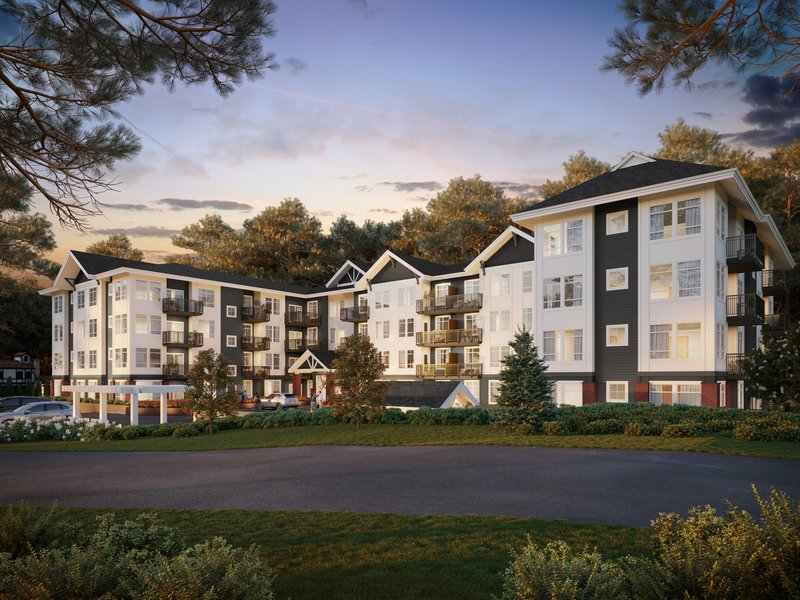
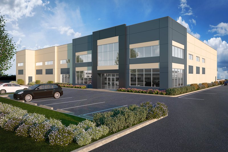
1. Architectural Renderings:
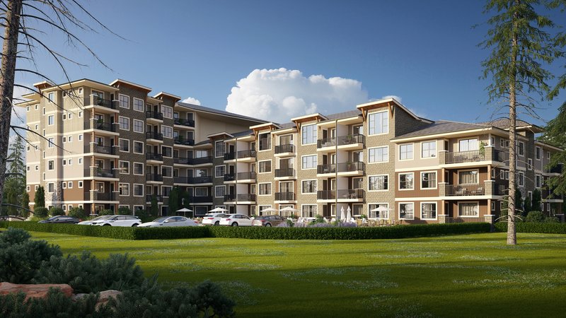
With an unwavering dedication to the field of architectural rendering, our focus as a company has been primarily on this domain for the past 16 years. We are deeply passionate about the transformative power of architectural renderings, as they allow individuals to catch a glimpse of the future. Even if a building is several years away from breaking ground, our renderings provide a means to breathe life into the visions of architects and developers, offering a hyper-realistic and exhilarating preview of what is to come.
Architectural renderings refer to the process of creating visual representations of architectural designs using computer-generated imagery (CGI) techniques. These renderings aim to communicate the intended look, feel, and functionality of a building or space before it is constructed. They serve as powerful tools to bridge the gap between imagination and reality, enabling stakeholders to visualize and evaluate architectural designs in a tangible and immersive manner.
Architectural renderings have revolutionized the way architectural designs are presented, captivating audiences with stunning visual representations that bring projects to life. This powerful tool has found extensive utilization in various industries such as architecture, real estate, and urban planning. By leveraging the capabilities of 3D rendering software, architects and designers can create immersive experiences that showcase their ideas with exceptional detail, presenting materials, lighting, textures, and spatial arrangements in a realistic manner. The impact of architectural renderings extends beyond mere aesthetics, enabling stakeholders to visualize and evaluate designs before construction commences, resulting in significant time and resource savings while ensuring a clear vision of the final product.
Benefits and Impact of Architectural Renderings on Stakeholders
Architectural renderings offer a multitude of benefits and have a profound impact on stakeholders:
Visualization and Evaluation: Renderings enable stakeholders to visualize and evaluate designs before construction, providing a clear understanding of the spatial qualities, aesthetics, and functionality of the proposed project.
Decision-Making: Stakeholders can make informed decisions based on the renderings, as they can assess the design's impact, explore different options, and provide valuable feedback to optimize the final outcome.
Marketing and Sales: Renderings are powerful marketing tools, attracting potential buyers or investors by showcasing the project's unique features, ambiance, and visual appeal.
Cost and Time Savings: By identifying design flaws or issues early on, renderings help in avoiding costly rework during construction. They also streamline the design process, reducing project timelines and associated expenses.
Stakeholder Engagement: Renderings facilitate effective communication and collaboration among architects, clients, investors, and other stakeholders, fostering a sense of ownership, engagement, and shared vision.
Who uses architectural rendering:
- Architecture: Architectural renderings are an indispensable part of architectural design, allowing architects to present their ideas to clients, investors, and regulatory bodies. They aid in securing project approvals, facilitating design discussions, and visualizing the final product.
- Real Estate: In the real estate industry, renderings are used for marketing and sales purposes. They enable developers and agents to showcase the potential of properties, attract buyers, and convey the unique selling points of a project.
- Urban Planning: Renderings are vital in urban planning to visualize proposed developments, infrastructure projects, or revitalization plans. They help urban planners and city officials assess the impact of these projects on the existing environment and evaluate their feasibility.
- Interior Design: Interior designers utilize renderings to present their design concepts to clients, allowing them to visualize and approve spatial layouts, materials, furniture arrangements, and decorative elements.
- Construction and Engineering: Architectural renderings aid construction and engineering teams in understanding the design intent and coordinating various aspects of the project, such as structural elements, mechanical systems, and site logistics.
Types of architectural rendering services:
Here are a few examples of architectural rendering services with some samples of the work we have done.
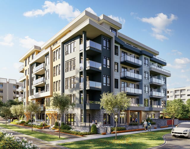
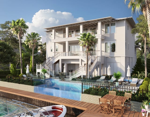
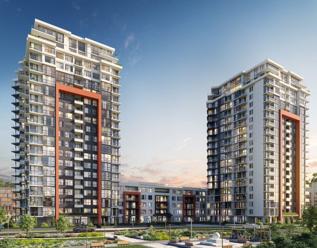
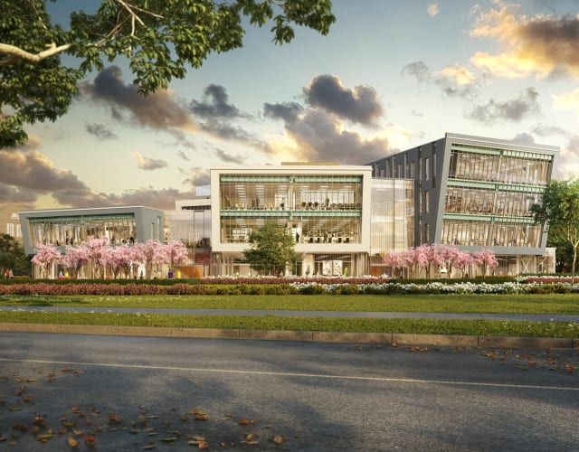
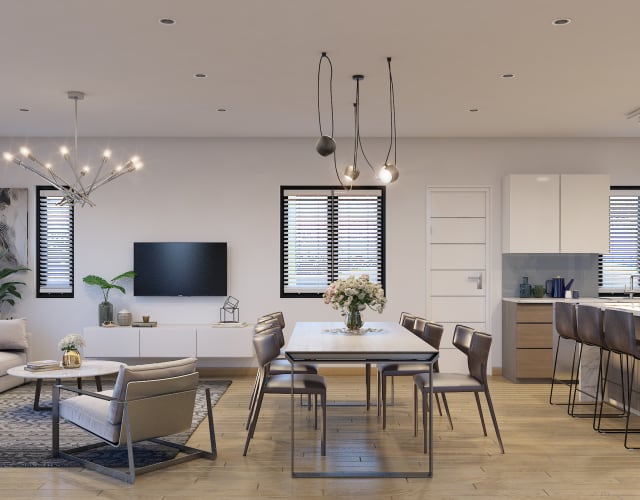
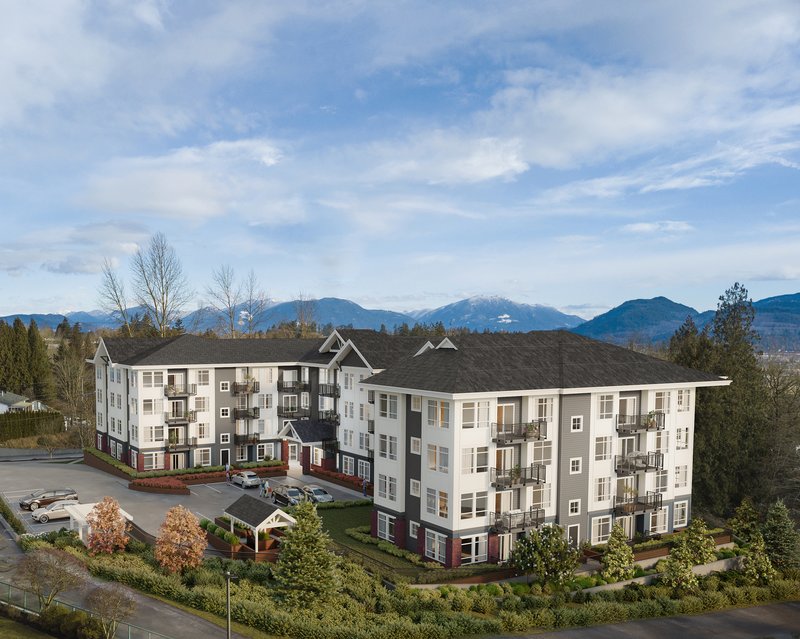
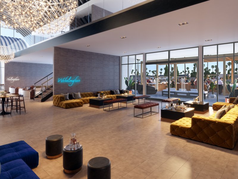
- Exterior Renderings: These renderings focus on showcasing the external appearance of a building or structure, including its façade, landscaping, materials, and overall architectural design. They can range from basic house renderings to large scale townhouse renderings or highrise renderings . Exterior Rendering s
- Timeframe: 4-8 days
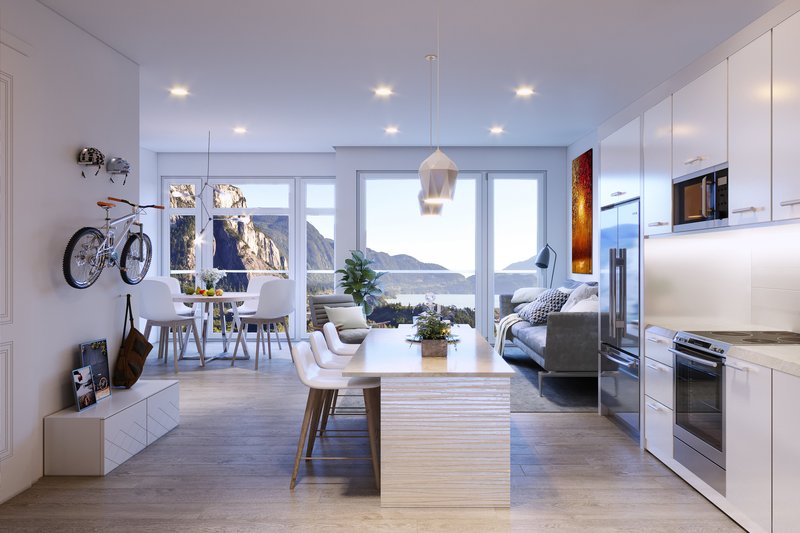
- Interior Renderings: Interior renderings provide a detailed visualization of the interior spaces within a building, including rooms, furniture, lighting, textures, and decorative elements. Interior Residential Rendering
- Timeframe: 3-6 days
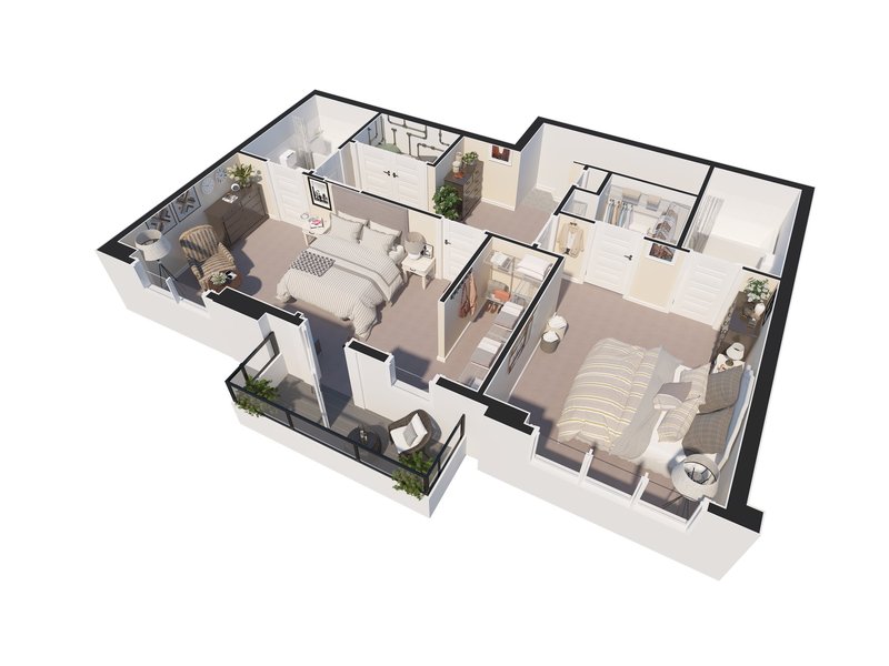
- 3D Floor Plans: This type of rendering presents a three-dimensional representation of the floor plan, offering a comprehensive view of the spatial layout, room dimensions, and flow of a building. 3D Floorplans
- Timeframe: 3-6 days
- Aerial Renderings: Aerial renderings provide a bird's-eye view of a project, illustrating its integration within the surrounding environment and showcasing the overall site design and landscaping. Often these images are created by merging drone photography with rendered elements. Aerial Rendering
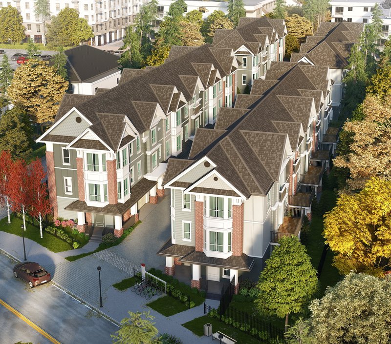
- Timeframe: 6-10 days
- Site and Master Plan Renderings: These renderings focus on presenting large-scale projects, such as urban developments or master plans, including the arrangement of buildings, open spaces, roads, and other infrastructure elements.
- Conceptual Renderings: Conceptual renderings capture the initial design concepts and ideas, often emphasizing artistic expression and creating a visual narrative that conveys the essence of the project.
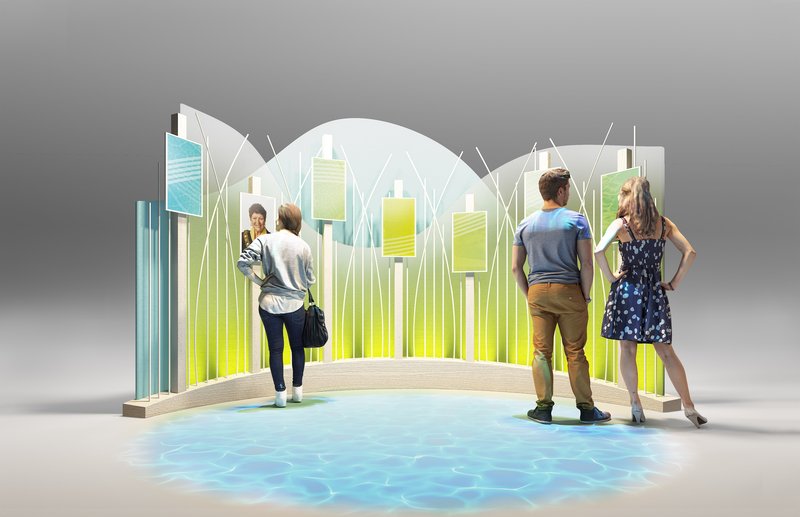
- Architectural Walkthroughs: Through animated sequences or interactive virtual tours, architectural walkthroughs offer a dynamic exploration of a project, allowing stakeholders to virtually navigate through spaces and experience the design in motion. Architectural Animation
- Timeframe: 2-4 weeks
- Virtual Reality (VR) Renderings: VR renderings utilize virtual reality technology to provide an immersive and interactive experience, allowing users to explore and interact with a virtual representation of the project using VR headsets or devices.
- Augmented Reality (AR) Renderings: AR renderings merge digital elements with the real world, superimposing virtual elements onto physical environments. This allows stakeholders to view and interact with digital overlays of architectural designs through mobile devices or AR glasses.
- Renovation Renderings: Renovation renderings depict proposed changes or upgrades to existing structures, allowing stakeholders to visualize the potential transformation of a building or space.
2. Product Renderings:
Product renderings are essential for showcasing products before they are manufactured. They help businesses present their designs in a compelling and photorealistic manner. These renderings highlight product features, materials, colors, and textures, allowing manufacturers to assess their products' visual appeal, ergonomics, and functionality. Product renderings are widely used in advertising, marketing campaigns, product catalogs, and e-commerce platforms to captivate customers and drive sales. They provide a cost-effective and efficient way to create lifelike representations of products, eliminating the need for physical prototypes in the early stages of development.
Who uses product rendering services?
- Manufacturing and Product Design: Product renderings aid in the design and development process, enabling designers to visualize and refine product concepts, evaluate form and functionality, and make design decisions before production.
- Advertising and Marketing: Renderings are invaluable in marketing campaigns, allowing businesses to showcase their products in visually captivating ways. Product renderings can be utilized in print ads, digital media, or packaging design to create engaging visuals that attract customers and communicate product features.
- E-commerce: In online retail, product renderings provide an accurate representation of products to potential customers. By showcasing the product from various angles, demonstrating its functionality, and presenting color or customization options, renderings help customers make informed purchasing decisions.
- Prototyping and Manufacturing: Product renderings aid in the prototyping and manufacturing process, enabling manufacturers to assess the product's manufacturability, plan production workflows, and provide accurate specifications to suppliers.
Benefits of 3d product renderings
- Customer Engagement: Renderings allow customers to visualize products before they are physically available, enhancing their engagement and connection with the product. This can lead to increased customer satisfaction and higher sales conversions.
- Cost and Time Savings: By identifying design flaws or issues early on, product renderings help businesses avoid costly mistakes during the manufacturing process. Additionally, the ability to iterate and refine designs in a virtual environment reduces time-to-market and associated expenses.
- Decision-Making: Product renderings provide stakeholders with a clear understanding of the product's design, features, and aesthetics. This enables informed decision-making regarding product development, marketing strategies, and investment opportunities.
3. Character and Creature Renderings:
Character and creature renderings play a pivotal role in the world of animation, gaming, and visual effects. Artists create digital characters, whether human, fantastical creatures, or anthropomorphic beings, and bring them to life through 3D rendering techniques. These renderings encompass everything from modeling and texturing to rigging and animation, resulting in lifelike and expressive characters. Whether it's a beloved animated film, a cutting-edge video game, or a jaw-dropping visual effects sequence, character and creature renderings transport audiences into imaginative worlds, invoking emotions and immersing them in captivating narratives.
4. Visual Effects in Movies and Animations:
3D rendering is at the heart of visual effects in movies and animations, enabling the creation of breathtaking and seemingly impossible scenes. From mind-bending action sequences to awe-inspiring environments, 3D rendering brings imaginary worlds to life with unparalleled realism. Visual effects artists use advanced rendering techniques to simulate natural phenomena, simulate physics, and seamlessly integrate computer-generated elements into live-action footage. The result is a seamless blend of reality and imagination that captivates audiences and pushes the boundaries of storytelling.
5. Virtual Reality and Gaming:
Virtual reality (VR) and gaming are immersive experiences that rely heavily on 3D rendering technology. In VR, realistic and interactive virtual environments are created using 3D rendering techniques, allowing users to explore and interact with digital worlds in real-time. Gaming utilizes 3D rendering to generate lifelike characters, intricate landscapes, and stunning visual effects. Real-time rendering engines power the gaming industry, enabling dynamic and responsive visuals that enhance gameplay and create immersive player experiences. From action-packed adventures to virtual simulations, 3D rendering is a fundamental element that brings virtual reality and gaming to life.
These diverse applications of 3D rendering highlight its significance across various industries, from architecture and product design to entertainment and virtual experiences. The ability to create realistic and visually captivating representations has revolutionized the way we design, communicate, and experience the world around us, opening up endless possibilities for creativity and innovation.