Aerial & Drone Rendering Services
Elevating Perspectives: Aerial and Drone Rendering Services
Aerial renderings that show the whole site in context
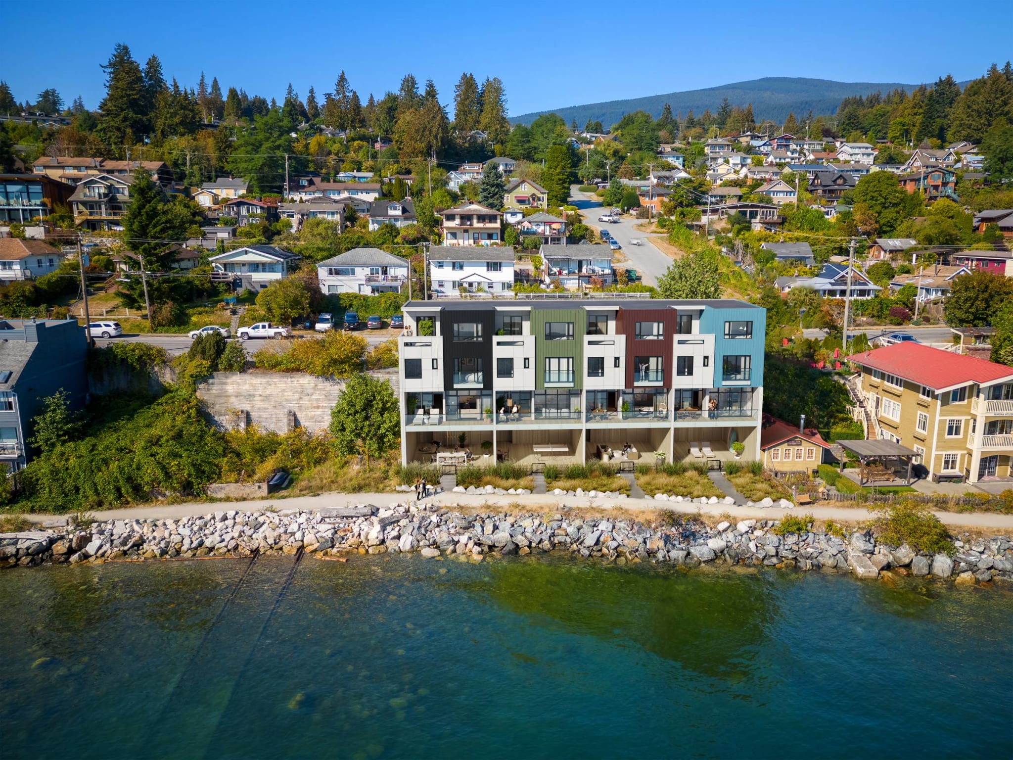
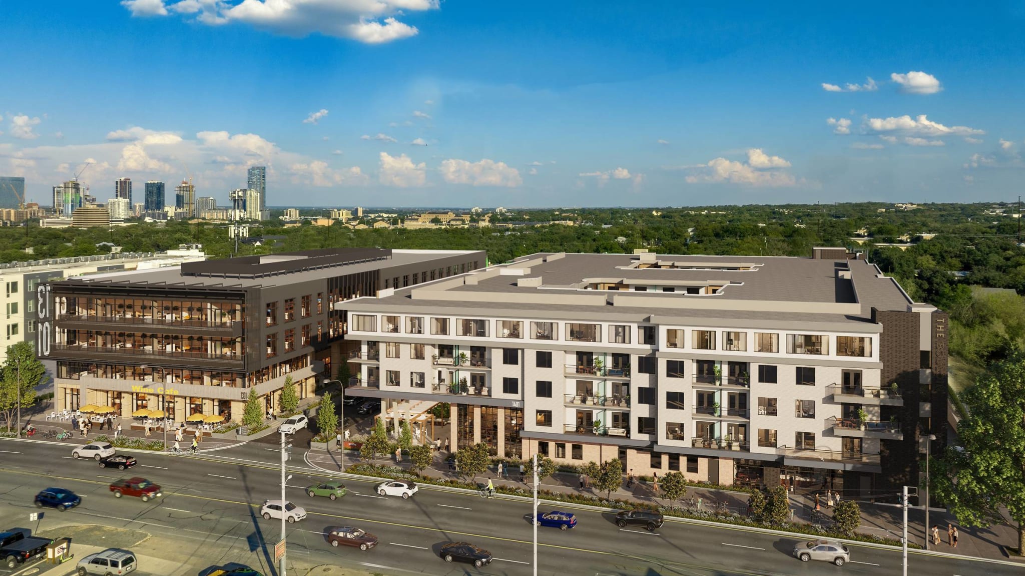
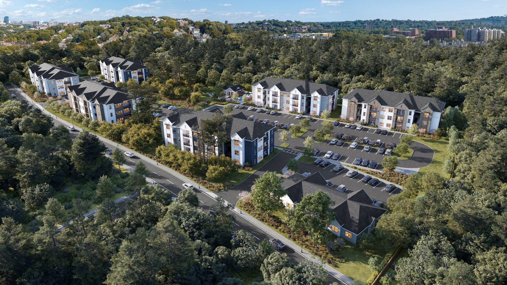
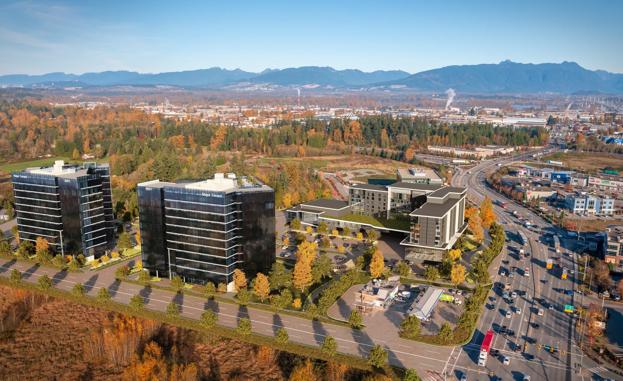
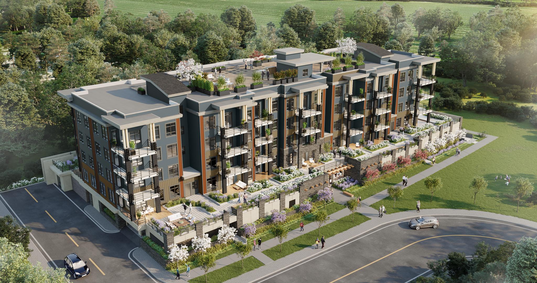
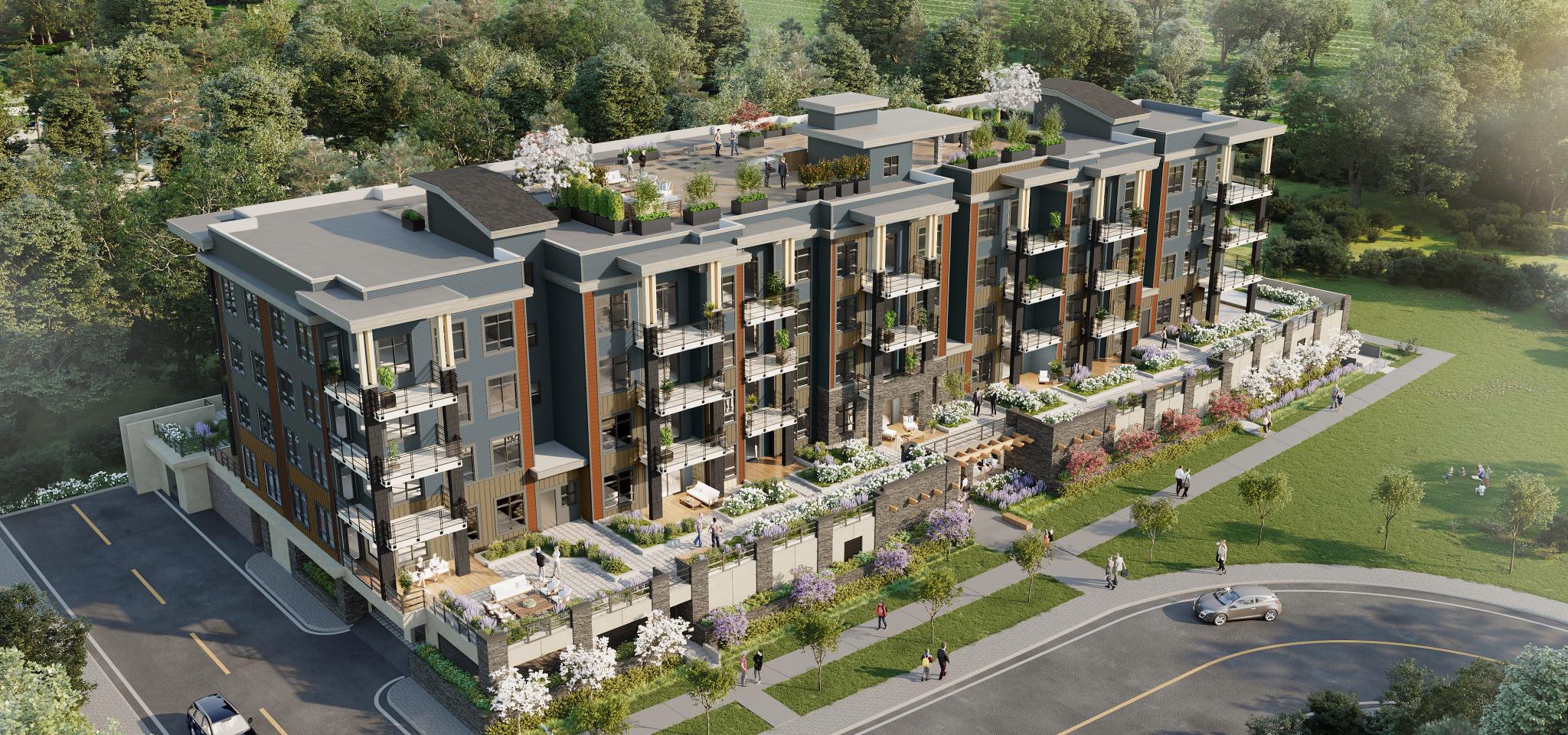
For 19 years, RealSpace3D has produced photorealistic aerial and site renderings for developers, architects, and builders, with 2,500+ projects delivered across the US and Canada. We build your project into its real surroundings — streets, neighbouring buildings, and terrain — for master plans, development applications, and marketing.
You work directly with a North American team — no offshore hand-offs — with three revision rounds included.
83%
of buyers' agents say staging helps buyers picture a home as their own.
Source NAR, Profile of Home Staging (2025)
Measures physical home staging (agent survey), cited as a visualization signal.
About Our Services
-Aerial Rendering Built for Real Projects
We create photorealistic aerial and site-plan renderings for developers, architects, and planners across the US and Canada.
What We Deliver
Photorealistic bird's-eye and drone-height views with your project modeled into real surrounding streets, buildings, and terrain.
- Drone-height & overhead
- Real context
- Print & signage
Our Process
Clay renders to lock camera height and angle, then fully-textured drafts — three revision rounds included — built from mapping and satellite data for accurate context.
- 3 revisions included
- Mapping-accurate
Who We Work With
Developers marketing master plans, architects showing site fit, and planners supporting applications and public consultation.
- Developers
- Architects
- Planners
Contact Us - Let’s work together
We can’t wait to hear from you.
Get in Touch
- info@realspace3d.com
- Phone
- +1 (236) 998-4385
- Office
- 170-422 Richards Street
Vancouver, BC, Canada
V6B 2Z4
Trusted by developers across North America
Average turnaround: 2-3 weeks
Commonly repeated
AI turns a text prompt into a finished, client-ready render.
The pitch behind a lot of cheap, overpromising operators.
What the research shows
AI is a concept tool, not a finished-render tool — the most recent industry survey found only ~11% of firms use it in visualization, mostly for early ideas.
Source State of Architectural Visualization 2024/25, Architizer × Chaos (2025)
Survey of 1,000+ design professionals (practitioner adoption).
Aerial renderings involve creating the entire scene using 3D assets, allowing for complete customization of the surroundings. This provides greater flexibility within the landscape, the ability to incorporate customized lighting, and up to three prospective camera angles during the clay rendering stage. Additionally, aerial renderings do not require a drone, making them suitable for capturing imagery in busy areas where drone flying may not be feasible.


On the other hand, drone renderings involve enhancing existing drone images by adding 3D elements, such as new developments or structures. This approach enables the seamless integration of 3D elements into stunning views captured by the drone. By incorporating these elements into the existing imagery, drone renderings offer a unique perspective and allow for a more realistic representation of how the new additions fit into the environment.
Whether you opt for aerial or drone rendering depends on your specific requirements and objectives. Aerial rendering offers complete control over the entire scene, while drone rendering leverages existing drone imagery to incorporate 3D elements seamlessly. Both approaches provide valuable tools for visualizing and presenting projects compellingly and realistically.
Potential Applications for Aerial Renderings:
- Real Estate Marketing: Aerial renderings can showcase properties from a bird's-eye view, providing a comprehensive overview of the surroundings and enhancing marketing efforts.
- Urban Planning and Development: Aerial renderings help visualize proposed changes to cityscapes, infrastructure projects, and urban developments, aiding in decision-making and public engagement.
- Architecture and Design: Aerial renderings enable architects and designers to present their projects in a contextualized manner, highlighting how buildings interact with their surroundings and the overall urban fabric.
- Environmental Analysis: Aerial renderings assist in analyzing and understanding the impact of development projects on the environment, such as assessing sightlines and shadows and preserving natural features.
- Tourism and Hospitality: Aerial renderings can showcase tourist destinations, resorts, and attractions, providing visitors with a comprehensive view of the surroundings and helping them plan their experiences.
Potential Applications for Drone Renderings:
- Design Visualization: Architectural rendering with drones provides a unique perspective by capturing aerial footage of the proposed design. This allows architects and clients to visualize the building within its context, understand how it interacts with the surrounding environment, and make informed design decisions.
- Marketing and Presentations: Drone-rendered architectural visuals create captivating marketing materials for promoting architectural projects. The ability to capture stunning aerial views and showcase the design features helps attract potential clients, investors, and buyers.
Helpful tips for getting the most out of your Aerial and Drone rendering project.
Getting Started To launch a successful aerial or drone rendering project, providing detailed information about the location you're visualizing is crucial. Clearly state the project's purpose, whether it’s for real estate marketing, urban planning, or another application, and supply necessary aerial or drone imagery. Include any architectural or site plans to ensure the renderings accurately reflect the accurate proportions and scale of the space.
Design Concept and Style Understanding the location's design concept and style is key. Specify the aesthetic you aim to showcase, whether architectural features or landscape design. Discuss any specific features or elements to be included in the renderings, such as new developments or landscape enhancements, and outline your preferences for lighting and atmosphere to guide the rendering process effectively.
Reference Materials Providing reference materials such as inspirational images, mood boards, or specific drone footage is essential. These materials help the rendering team grasp the desired atmosphere and aesthetic details of the location, ensuring the renderings align with your expectations.
Rendering Specifications Define the specific requirements for your project, including the number of renderings, camera angles, and the level of detail desired, such as textures and materials. Discuss any dynamic elements or animations needed to bring the design to life, ensuring that these are communicated clearly to the rendering team.
Timeline and Budget Discussing the timeline and budget is critical for a smooth collaboration. Specify the project deadline and budget range to allow the rendering company to plan accordingly. Also, clarify the expectations for revisions or adjustments to streamline the project and prevent misunderstandings.
Frequently Asked Questions About Aerial Rendering
What is an aerial rendering?
An aerial rendering is a photorealistic bird’s-eye view of a project showing the building, site, surrounding streets, neighbouring properties, and broader context. It is often used in marketing materials, development applications, and public presentations where the project needs to be understood at a larger scale.
How much does an aerial rendering cost?
Aerial rendering costs vary depending on site size, surrounding context, level of detail, and turnaround requirements. For a more detailed overview of typical pricing, please visit our pricing guide.
What is the difference between aerial and site plan rendering?
An aerial rendering is a photorealistic 3D bird’s-eye view showing the building and its surroundings in context. A site plan rendering is usually a simpler top-down view focused on layout, boundaries, circulation, parking, and landscape organization. We offer both depending on the goals of the project.
What files do you need to create an aerial rendering?
We typically work from architectural site plans, building elevations or 3D models, and any available landscape or civil drawings. To build accurate surrounding context, we also use mapping data and satellite imagery to model neighbouring buildings and terrain.
Can aerial renderings be used for municipal approvals?
Yes. Aerial renderings are often used in development applications, public consultation materials, and planning presentations because they help reviewers understand how a project fits into the surrounding neighbourhood.
How long does an aerial rendering take?
Aerial renderings usually take 6 to 12 business days, depending on the amount of surrounding context that needs to be modeled. Because they include neighbouring buildings, terrain, and site relationships, they are typically more involved than a standard exterior rendering.